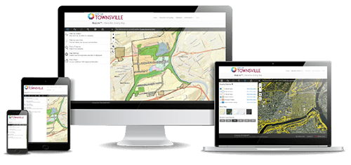
Interactive Zoning Map
Over 1.5 Million Citizens Benefit From the Convenience of MapLink
MapLink is a Visual Zoning™ service that presents the essential elements of your community’s zoning code through an interactive online map on the ZoningHub platform.

Simple, online access to zoning code regulations

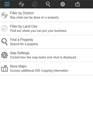
Quickly find property details that can help answer key zoning questions
“What can I do with my property?”
“Where can I open my business?”

Spur community development and resiliency
Helps business owners and developers confirm zoning details that are essential for streamlining plan approvals.
Easy to use and simple to manage
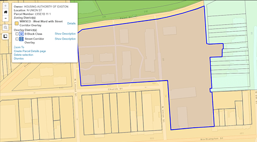
Created from your municipality’s existing GIS Shapefiles, MapLink’s intuitive design allows for easy navigation so businesses and property owners can quickly find dimensional requirements, allowable uses, zoning districts and other essential property information.
Give MapLink a Test Drive
Click the map to quickly zoom into an individual parcel and examine zoning requirements in greater detail, or search for properties in your municipality based on intended land use. You can even click to see more details in your online code.
Give MapLink a Test Drive
MapLink is a Visual Zoning Service from General Code
From online zoning maps, to flexible design enhancements for graphically-rich or form-based Codes, our Visual Zoning services offer smart options that your municipality can provide to property and business owners so they can see what’s possible for their property—and grow your community.
Maintain your graphically-rich zoning code with Enhanced Graphics.